History
Woudrichem is strategically located at the confluence of Maas and Waal, at the junction of 3 provinces. The Land of Altena, to which Woudrichem belongs, belonged to the County of Holland from 1322. Only in 1815 was it assigned to the new province of North Brabant.
Woudrichem received city rights in 1356. In that year, the burial river toll of Niemandsvriend was also moved from Sliedrecht to Woudrichem. A few years later, the town also received fishing rights, and flourished. The Martinus Church and city walls date back to this time.
In 1420, the toll was moved to Gorinchem. This event, the Saint Elizabeth Flood of 1421 and the many military conflicts the town was involved in because of its location, caused the decline of the town.
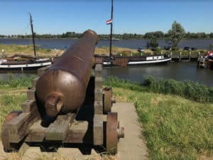
The many sieges have left their mark in Woudrichem. In 1573, the Beggars set fire to the town. They considered it indefensible. A new city wall was then thrown up, protecting a smaller area than the old city wall had done. This city wall is the fortified town wall that still surrounds the center.
In 1814, Woudrichem became part of the New Dutch Waterline. No construction was allowed in the surrounding land from then on. It was not until 1955 that the fortified town was disbanded and new residential areas were built around the town.
The historic city center is a protected cityscape.


