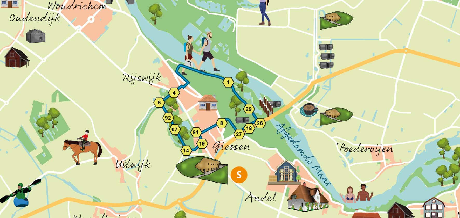
This hike has the parking lot of Fort Giessen as its starting point. Fort Giessen is another gem of the New Dutch Waterline. Should it be open, let the guides tell you about the history of the fort and its surroundings or let the people of nature association Altenatuur give you information.
We walk down the road with the fort at our backs and turn right into Burgstraat. Even before the first bend, we take the loam footpath on the left with pollarded willows on both sides. We walk parallel to the little river Alm, which we can occasionally see. After a while the path turns into a paved road, the Karbogerd, which we continue to follow. After the long right turn, over the bridge but before the sports fields, we turn left into the hiking path that takes us through the Almbos. We keep following this path and via 92 (there are the nodes again) we walk to 06. There we turn right towards 04 at the traffic circle. We cross the traffic circle straight over and follow the Rijswijksesteeg which becomes the Dorpsstraat. In the bend we turn left onto the Stoep. Now we have to search a bit: we cross the dike and to the right behind the church we find a cart track going down. We cross the water and immediately turn left. We keep following this path, with the water on our left, and at the very end we clamber up the dike. We take a breather from the climb and turn right. On the paved path on the dike we continue walking, with views of the river on the left and farmland on the right. The path is adorned by a motley bouquet of wildflowers and, with the wind in our hair, we fully enjoy it. We walk straight through 01 and 29 to 26. There we turn right along the Provincial road towards 18 and 27, where we descend the stairs to the right towards 08. We are surprised by the sweet winding path with fruit trees along it. At the church at the end of this path we end up back in the village center. Via 91 and 19 we arrive at the starting point, junction 14, Fort Giessen. Tip if you still have time and energy: take a look at the experience park at the fort dedicated to World War I or walk around the fort again.
Overview of all our routes in the Nieuwe Hollandse Waterlinie
Activity: hiking