Between the rivers Maas and Merwede lies the Biesbosch Line, an island of tranquility between Holland and burgundian Brabant. Vast, tranquil and rugged, the Biesbosch Line is characterized by its rich variety of heritage. You will find ancient farms, churches, mills and the southernmost part of the largest monument of the Netherlands: the New Dutch Waterline. Partly because of its rich history, it is a fantastic area for cycling, walking and boating. Because of its central location, the area offers a good base for day trips to, for example, major cities such as Den Bosch, Utrecht or Breda. And what about a day at the Efteling or Kinderdijk? Whatever your plans: feel welcome! This is where your adventure begins!
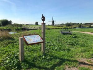
National Park De Biesbosch is located largely on our island. You can walk, bike or drive there without crossing the water. In recent years, a large area adjacent to the National Park has been shored up to make room for river water. This area is a wonderful lead-in to the National Park, so well done in fact that you don't know exactly where the park boundary actually begins. At the heart of De Biesbosch is the Biesbosch Museumeiland where you can learn more about the origins of the National Park and about the delta. Our region also has several other beautiful places to enjoy nature. Like the floodplains between Sleeuwijk and Woudrichem or those along the dammed Maas, the Kornsche Boezem, also called the small Biesbosch, with its mill and the Pompveld near Waardhuizen. All are gems we would like to point out to you. But, also if you 'just' walk or bike a nice route you can enjoy beautiful field edges, old tree lanes, large birds of prey, storks and partridges.
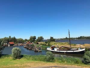
Surrounded by water, the Biesbosch Line is an island within the province of North Brabant. And as islanders, we are just that little bit different! Farmers cultivate the clayey fields reclaimed from the water. After the Sint Elisabethflood in 1421 there was a lot of work to do, large parts were flooded. That's actually when this island was created. Fighting and living with the water is still part of our lives. Bridges and (highway) roads now open us up and make us easily accessible. In addition, numerous ferries sail up and down the various rivers to bring people to the other side (and back again). Special ferry connections include: The fortress-3-corner a day trip along parts of the New and Old Dutch Waterline, on the electric bike to National Park De Biesbosch and crossing with ferry Sturgeon (and you cross a nice bit too!) or the foot ferry to Slot Loevestein from Woudrichem.
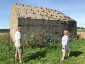
Inescapable icons in the landscape are the heritage in the Biesbosch Line. A beacon along a route, a point in the distance, a surprise along the way. Our heritage tells the story of who we are and how we came to be. Mills ground the polders dry and flour for the baker. Farms were storehouses for hay, straw, animals and people working the land to feed mouths. The Nieuwe Hollandse Waterlinie, a defense line, provided security for the Randstad and left behind beautiful forts and casemates. You can sleep in one of those forts, live in another, have a nice lunch and party in the third, and the fourth is dedicated to WWI. And all this beauty can be visited!