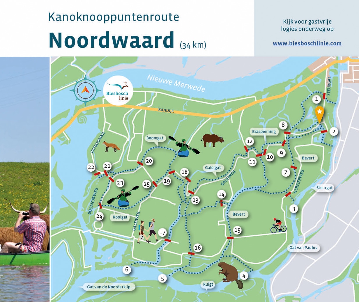
A canoe route from node to node through the Noordwaard in the Biesbosch. On this map of the Noordwaard the waterways are marked with numbers. You can make your own route along these nodes.
The Noordwaard is a flow-through area. Water levels are subject to the influx of river water. At high tide, the designated fields flood and the current will be stronger. It is then advisable to choose calmer waters.
The Noordwaard is a special area that has looked different over the centuries. It was once countryside full of small hamlets, and turned into an inland sea after the Sint Elisabethflood of 1421. And then, via reclaimed land, it changed into a flood plain to make room for the river.
In the Noordwaard you can seek the silence and enjoy from the water, for example, a herd of grazing water buffalo or a fishing kingfisher. The creeks meander through the landscape making the view surprisingly different each time.
You are not out of here just like that, as there are about thirty kilometers of boating route in this area and you do not need to be an experienced canoeist to explore here.