style="background-image:url(https://biesbosch line.com/wp-content/uploads/2021/10/VVVBiesboschlinie_WinterWonderWoudrichem-srgb-scaled.jpg);background-size: cover;" >

Enjoying winter in the Biesbosch Line

Press Release

Oct. 7, 2021

The Biesboschlinie also bustles with numerous activities in winter. There is something for everyone: from winter hiking or candlelight tours to atmospheric shopping for the holidays. All activities are collected in a handy winter guide.

Winter in the Biesboschlinie
From December through February, winter rest reigns in the Biesboschlinie. But that doesn't mean there's nothing to experience. At Winter Wonder Woudrichem, everyone gets in the mood for the holidays. All months there are winter walks for a breath of fresh air, musical performances at Kasteel Dussen and for the old-fashioned winter feeling the washerwoman gives tours of Fort Altena.

Activities in the Fortified Town Triangle
Winter is also anything but dull with our neighbors in the Fortified Town Triangle. Tours by candlelight at Slot Loevestein or ice skating at the Gorcums Winterfestijn: plenty to do for a complete weekend visit to all the fortresses.

Winter Guide
The Biesbosch Line is home to ancient heritage and beautiful nature. The area covers the municipality of Altena with its 21 towns, including Woudrichem, and the southern part of the Biesbosch. There is a lot to enjoy ... also in winter. Therefore, VVV Biesboschlinie collected the activities for this winter in a winter guide. The guide is available from the end of November at tourist locations in the region and digitally via https://biesboschlinie.com/en/winter .


400 years ago, on March 22, 1621, Hugo de Groot escaped in a book chest from Slot Loevestein. That prompted the declaration of 2021 as Hugo de Groot Year. Did you know that a famous part of Hugo de Groot's life took place a stone's throw from the Biesbosch Line?

If you stand facing the river and look from the quay walls of Woudrichem to the right, you see Slot Loevestein, where Hugo was imprisoned. If you look to the left, you see Gorinchem in the distance. In his book chest, he sailed to this town, to flee from there to freedom. Do you remember who Hugo de Groot was? What were his views and why was he imprisoned at Loevestein? We refresh your memory in this blog.

Delft, April 10, 1583

Hugo de Groot is born into a well-to-do, intellectual family. His father was mayor of Delft at the time. It soon became apparent that Hugo learned extremely quickly: at the age of 8 he was already fluent in Latin and Greek. He went through the Gymnasium in Delft, and when he was 11 years old he moved into a host family in Leiden to study humanities at the university. After his graduation and doctorate, he settles in The Hague. There he sets up a law practice and fulfills a variety of public functions.

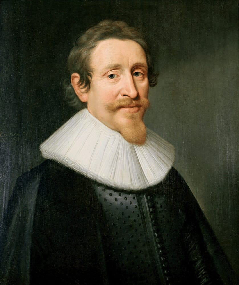
Portrait of Hugo de Groot by Michiel Jansz van Mierenvelt. Hugo is a white man short dark blond hair and a goatee. He wears a black robe with a large white collar.
Hugo de Groot, by Michiel Jansz van Mierenvelt

Twelve-year truce

Hugo de Groot lived during the time of the Dutch Revolt, or Eighty Years' War (1568-1648). It is a turbulent time, which has a great influence on his course of life and thought. In 1609, a truce is declared in the war between Spain and the Netherlands. The Spaniards are in bad shape financially and are also waging war on multiple fronts. The pause suits them.

Political divisions

On the contrary, the Netherlands is divided over this truce. Council pensionary Johan van Oldenbarnevelt is in favor. He sees opportunities in the truce to strengthen the trading position of the Netherlands. Stadholder Maurice, commander-in-chief of the armed forces, is not pleased. Together with Willem Lodewijk, stadholder of the provinces of Groningen and Drenthe, he fears that the Spaniards will recover and achieve a crushing victory over the Netherlands after the truce. In addition, Maurice's political influence diminishes considerably in peacetime. With the armed forces inactive, Van Oldenbarnevelt has the upper hand, and that stings.

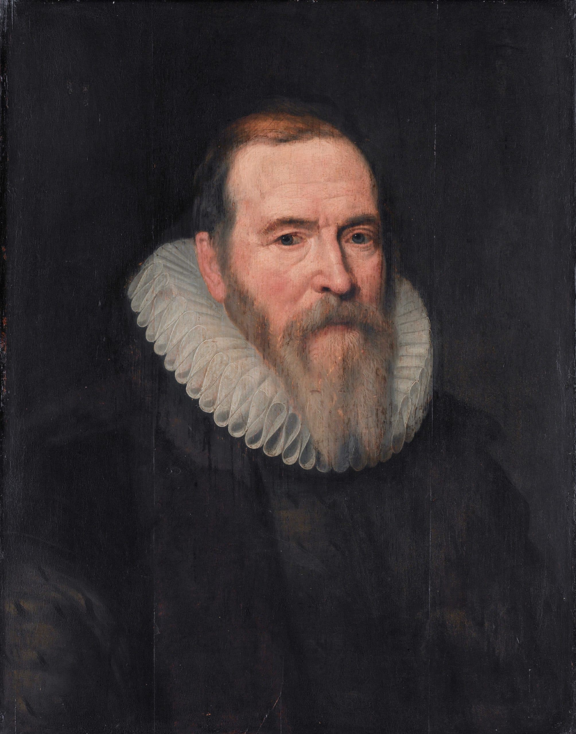
Portrait of Johan van Olderbarnevelt
Johan van Oldenbarnevelt, circa 1616. From the studio of Van Mierenvelt.

Religious divisions

During the pause in the fray, religious divisions in the Netherlands also became apparent. Until then, the Protestant - or at least "tolerant" - Netherlands marched together against the Catholic Spaniards. Now that that common enemy is not in the picture, the different views among Protestants lead to conflict. Remonstrants face off against counter-demonstrants. Van Oldenbarnevelt sides with the Remonstrants, as does his political ally Hugo de Groot. Maurice sided with the Counter-Remonstrants. Tensions run high, leading to riots in the cities. Van Oldenbarnevelt believes that peace must be maintained in the Republic, and has the States of Holland pass the Sharp Resolution. This resolution empowers the cities of Holland to hire mercenaries (waardgelders) to act in the event of riots against remonstrants.

This is against Maurice's wishes. After all, he was commander of the armed forces, and now that position too was in trouble. With the approval of the States General, he fired the worthies and had Van Oldenbarnevelt and a number of his supporters arrested. One of those supporters is Hugo de Groot. Van Oldenbarnevelt receives the death penalty, Hugo is sentenced to life imprisonment. He is transferred to Slot Loevestein.

(text continues below inset)

Experience the Hugo de Groot year from the Biesbosch Line

Are you experiencing the Hugo de Groot year with us? The Biesbosch Line is the perfect place to experience the exciting journey of Hugo de Groot in his book chest. From Woudrichem it is a stone's throw by ferry to Loevestein Castle. There, a special exhibition on Hugo de Groot is currently on display. You get insight into his thinking, but also learn how his ideas are still relevant to current issues today.

After visiting Loevestein, take the ferry to Gorinchem. There you can visit the gate through which the book chest was brought into the city. With your cell phone, explore its escape route using special posters with QR codes and learn all about one of the greatest Dutch scholars in history.

Trapped at Loevestein

At Loevestein, Hugo's freedom is taken away from him, but he does have permission to write and study there. Therefore, he regularly receives a chest full of books. A befriended bookseller in nearby Gorinchem fills the chest for him, and also takes the books back.

Hugo's wife, Maria van Reigersberch, lives with Hugo at the castle, as does his maid Elsje van Houweningen. They are both allowed in and out freely. When after several months the controls on the book chest slacken, Maria sees opportunities for Hugo's escape. Night after night, she has him practice being able to sit in the coffin for several hours without moving. On March 22, 1621, the day of the Annual Fair in Gorinchem, the time has come. Maria puts the books with Hugo's clothes in bed, Hugo crawls into the book chest. When the soldiers come to collect the coffin, Elsje travels with the coffin to distract the soldiers if necessary. The plan succeeds. Hugo, after a stop at the bookstore, travels disguised as a bricklayer via Antwerp to Paris.

Exile

In France, Hugo is welcomed with open arms; King Louis XIII even grants him an annual stipend. He can therefore devote himself quietly to writing and studying.

In 1631, he returned to the Republic. He estimates that the worst of the storm has passed, especially now that Maurice has died and his son Frederick Henry has succeeded him. He even opens a new law practice. Several senior figures such as the poet P.C. Hooft even argue for his amnesty. However, the States General demand that Hugo apologize, which he refuses. He is convinced that he has done nothing wrong. The States then issue a new arrest warrant and Hugo again goes into exile.

From 1634, Hugo de Groot worked as a Swedish state envoy in Paris. 10 years later, Queen Christina of Sweden calls him back to the Swedish court. She wants Hugo to advise her on foreign policy. In addition, she wants him to set up a scientific library for her. Both Hugo and his wife feel little interest in this, also because they do not like the inclement climate in Sweden. Thereupon the Swedish court dismisses him. On his crossing back to mainland Europe, his ship sinks. He manages to get to safety, but becomes exhausted on the long journey home and falls ill. On Aug. 28, 1645, he died in Rostock, Germany. Hugo de Groot is buried in the Nieuwe Kerk in Delft.

Hugo de Groot, scholar and writer

Hugo de Groot is the author of a large number of works. He was extremely versatile, and his work shows this. The work consists of both Latin and Dutch tragedies and poems, translations of classical works, as well as theological, historical and legal treatises.

Best known are the works De iure belli ac pacis (On the Law of War and Peace) from 1625 and Mare Liberum (The Free Sea) from 1609.
De iure belli ac pacis discusses the rules and laws of just warfare. The work is considered the basis for modern international law.

The same is true of Mare Liberum. In this work, Hugo de Groot argues that the seas should be open to all for free trade and travel. Although he wrote the work to refute Spain and Portugal's claim to exclusive rights to trade in the West and East Indies, to this day it is the standard for current maritime law. Every country, even today, has a right to free passage through the seas beyond its territorial waters.

Title page 'Mare Liberum' by Hugo de groot
Title page 'Mare Liberum' by Hugo de Groot

Press Release

June 10, 2021

In 2021, VVV Biesboschlinie will bring an "Ode to the Landscape" of Altena. Throughout the Netherlands this summer, the Dutch landscape is in the spotlight. That landscape is incredibly varied. Nowhere in the world is there so much diversity in such a small area as here. One of the eye-catchers in this varied landscape is the Dutch Waterline. Through the centuries water has been used as an ally here, and our region also celebrates this with numerous activities.

Fort Safari
July 2 Fort Bakkerskil - At the southern tip of the Nieuwe Hollandse Waterlinie, Brabants Landschap is organizing an active safari at sunset. Together with the forester you go out on the water in a canoe. You can enjoy the silence and the gently rustling reeds. Passing kingfishers, diving cormorants and gnawing beavers might just accompany you during the canoe trip. On the way the forester will provide you with a snack and drink, so you can continue with new energy.
August 11, 18 and 25 Fort Giessen - During the fort safari the forester of Fort Giessen takes you on a discovery tour through the nature around the fort. You will discover that nature is still able to provide animals and humans with necessary vitamins, nutrients and, if necessary, bandages.

Pop-up restaurant Strong Water
StrongWater is a traveling restaurant that tells the history and future use of the Nieuwe Hollandse Waterlinie. At all kinds of locations along the line we will set up camp. On forts, castles, between special buildings and surrounded by beautiful flora and fauna, you will experience the line to the fullest. Taste the special dishes that have a link to the defense work and experience the history of the Nieuwe Hollandse Waterlinie in a special way. From July 8, Strong Water will set up camp at Fort Giessen.

Bicycle tour along the forts of the Biesbosch Line
Whoever says Water Line, says forts. How much fun is it to see them on a bicycle tour? A special route of 70 km takes you through the green landscape of the Biesbosch Line, past four forts, two inundation sluices and fortified town of Woudrichem. Along the way you will come across several group shelters and casemates, and you can take a look at the forts Bakkerskil, Altena and Giessen.

We close the lines
In the evening hours of September 3, 4, 10 and 11, 2021, we close the lines, literally. In cooperation with Rijkswaterstaat and the water boards, we will test as many parts of the Hollandse Waterlinie as possible. At various locations you can have dinner or a drink, after which you will discover the secrets of the water line with light, image and sound. In Woudrichem, we close the Sept. 11 Loevestein Gate, and a storyteller and projection on the fortified town wall complete the evening. Dine at Slot Loevestein or the fortified town of Woudrichem.

Liniepadfestival
This year the Liniepadfestival also brings an Ode to the landscape of the Dutch Waterline. The festival will take place from September 11 to 19, between the weekend of Open Monumentendag and the first art weekend of foundation Kunst in Almkerk. The Liniepadfestival lets you enjoy the landscape along the waterline with music, theater, heritage and landscape art. A special bike and walking route connects the town hall with the Liniepad and the forts of the Dutch Waterline.

Information on activities at www.biesboschlinie.com


Press Release

May 11, 2021

Boating with the wind in your hair and the sun in your face is something to look forward to this summer. With the wetlands of the Biesbosch and Altena, the Biesboschlinie is a wonderful area for recreational boating. VVV Biesboschlinie launches this month the canoe/kayak guide with 7 routes in the municipality of Altena and a new junction system through the Biesbosch.

Cool off on the water
From the water you get a whole new view of the landscape. Explore the Biesbosch by canoe or choose one of the other trips from the new guide. At www.biesboschlinie.com you can download all the different canoe/kayak trips. Don't feel like being active? Set sail on one of the region's many ferries, or rent a sloop or motorboat. Even with your own vessel, there are plenty of opportunities for a watery stay in the Biesbosch Line.
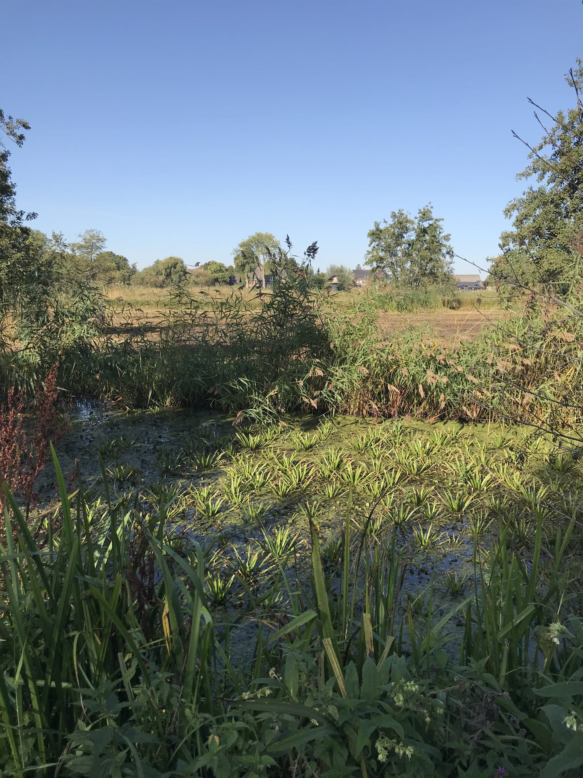
New: Canoe nodes Noordwaard
The Noordwaard is a special area that has looked very different over the centuries. From countryside full of small hamlets, to inland sea after the Sint Elisabethflood of 1421. And then, via reclaimed land, to flow-through area to make room for the river.

Here you can seek the silence and enjoy from the water such as a herd of water buffalo and kingfishers. The creeks meander through the landscape, providing surprisingly different views each time. There is about thirty kilometers of sailing route in this area, also suitable for novice canoeists.

Round trips
Also fun on the water this summer: from the Biesbosch MuseumEiland start - as soon as the museum is open again - several round trips. You can take whisper boats through the Brabant part of National Park the Biesbosch. These electric boats ('Whisper', 'La Silence' and 'Ohsostill') have 45 seats each. Thanks to their shallow depth, they sail through narrow creeks and ditches.


De Biesbosch and water belong together like a kayak and paddle. From its first emergence after the Elisabeth Flood of 1421 until today, the landscape in the Biesbosch has been defined by water. Yet that landscape has changed considerably in recent years. The Room for the River program changed our view of how we deal with water. We no longer just contain it, but give it space wherever possible. That results in dry feet and beautiful nature.

Noordwaard

The Noordwaard is one of the areas that have been tackled in recent years to make room for the river. It is an area of some 4,450 hectares on the Nieuwe Merwede, on the north side of the Biesbosch National Park. From 2010 to 2015, the area was de-poldered: what was once inner dike territory now became outer dike. The dike was lowered, allowing the Nieuwe Merwede to overflow its banks at high tide. This happens several times a year, especially in winter when meltwater and rainwater cause the water levels to rise. But not the entire polder is flooded: high quays have been built in a number of places so that roads and houses remain dry.

Enjoying space for water

Those dry feet are nice, of course, but room for the river also means there's a lot to enjoy outdoors. We give you an impression of what's on offer in the Biesbosch Line:

Space for nature

Where water is given free rein, nature changes. In the Biesbosch, shallow lagoons, channels and mud flats became the domain of migrating freshwater fish. Groups of spoonbills, common terns and egrets populate the area, and sea eagles and ospreys are now among the permanent residents. In Noordwaard, large grazers keep the area open to the water. Canoeing through shallow creeks, and hiking through marshy and rugged marshland, you may just come face to face with a water buffalo or konik horse.

Water buffalo in the Noordwaard

In the Noordwaard, water buffalo graze the areas outside the dikes, which is unique for the Netherlands. The buffalo feel very comfortable there. The area is wet, and they find plenty of food. The buffalo were released here for a specific purpose: they like to swim and travel long distances. Moreover, they are a lot bigger than Scottish Highlanders or Koninck horses, which allows them to digest rough food such as old reeds or cattails, in places where the other grazers do not come easily. They have thick skin, which is why in summer you often see them in the water to cool off. It is still quite an experience to encounter one, but keep enough distance. Water buffalo are not dangerous, but they are curious.

Biesbosch museumeiland

At the Biesbosch Museum, you can learn all about how we lived and live together with the water. From the first emergence after the St. Elizabeth flood to smuggling routes in World War II, it's all covered in the exhibits.

Outside, you can experience for yourself how the Biesbosch prevents higher areas from flooding. In the scale model of the Biesbosch Beleving you can slide and turn knobs yourself to see how you influence the course of the water with polders and dikes.

Photo National Park De Biesbosch

Sailing

A watery landscape is of course best discovered from the water. Rent a canoe at one of the rental points, and go on a voyage of discovery through the many creeks, streams and canals in the Biesbosch Line. Certainly the Noordwaard is easiest to explore by canoe.

Prefer something a little less sporty? Rent a hybrid sloop and sail around the Biesbosch. Or how about a bicycle tour that includes crossings by the various ferries? If you want to enjoy yourself luxuriously let yourself sail around on a canal boat or one of the region's skippers for a wonderful day out.

Canoe routes in the Biesbosch Line.

We've collected the most beautiful canoe routes for you in our canoe guide. Bring your canoe, or rent one at the rental points in Altena.

Planning your own route? With the canoe node route through the Noordwaard you choose your own route, without getting lost!

Landscape Art The Washing Moon

In the Noordwaard you will find the artwork "the Washing Moon," by artist Paul de Kort. It is landscape art: a labyrinth of water channels and dikes that changes with the tides, weather and seasons. De Wassende Maan is art and nature at the same time. Therefore, you will not immediately notice that there is a labyrinth hidden in the landscape as you walk along it. You won't see it until you climb the hill in the middle of the artwork.

Press Release

Jan. 19, 2021

Peace and space, sturdy forts, fortresses and Brabant hospitality: that's the Biesbosch Line. The Biesbosch Line lies on the border of North Brabant, South Holland and Gelderland. The area, with Woudrichem as its most famous town, is surrounded by rivers, forming an island. The region offers something for everyone. Nature lovers will find numerous nature reserves - including the Biesbosch - and culture lovers can also indulge in the forts and fortresses of the New Dutch Waterline.

Walking through the Waterline
The Biesbosch Line contains the southernmost part of the New Dutch Waterline. These defenses have been nominated for Unesco World Heritage status. The region is home to no fewer than 4 forts, 2 inundation sluices, dozens of casemates and the fortified town of Woudrichem. The available hiking trails are ideal for discovering this heritage and its surroundings.

Forts and Fortresses
In "the land of Altena," 3 of the 4 forts are open to the public. Each has its own character: from bed & breakfast or museum to educational fortified town. The fortified town of Woudrichem is also worth a visit. Between all this history lie floodplains, rivers, reservoirs and forests for lovely walks.

Casemates
The New Dutch Waterline runs right through the Biesbosch Line. From Woudrichem to Werkendam, the casemates lie like a chain through the landscape. They have lost their original function as group shelters, but they are not just in the way. They are now used, for example, as bird-watching shelters or as wintering places for bats. A number of casemates are open to the public, such as the dome casemate at Fort Altena. Walk the walking route 'Rondje Fort Altena' and visit the dome casemate along the way.

Overvaren
Those who just can't get enough of the Waterlinie will also find the Biesbosch Line the perfect base for a visit to Gorinchem or Slot Loevestein. From Woudrichem, several ferries, including a foot ferry, sail directly to these fortresses.
Leave the hustle and bustle behind, and come and enjoy yourself in the Biesboschlinie! www.biesboschlinie.com


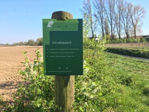
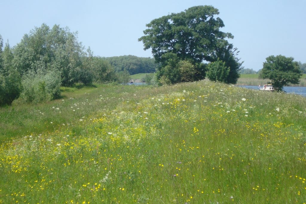
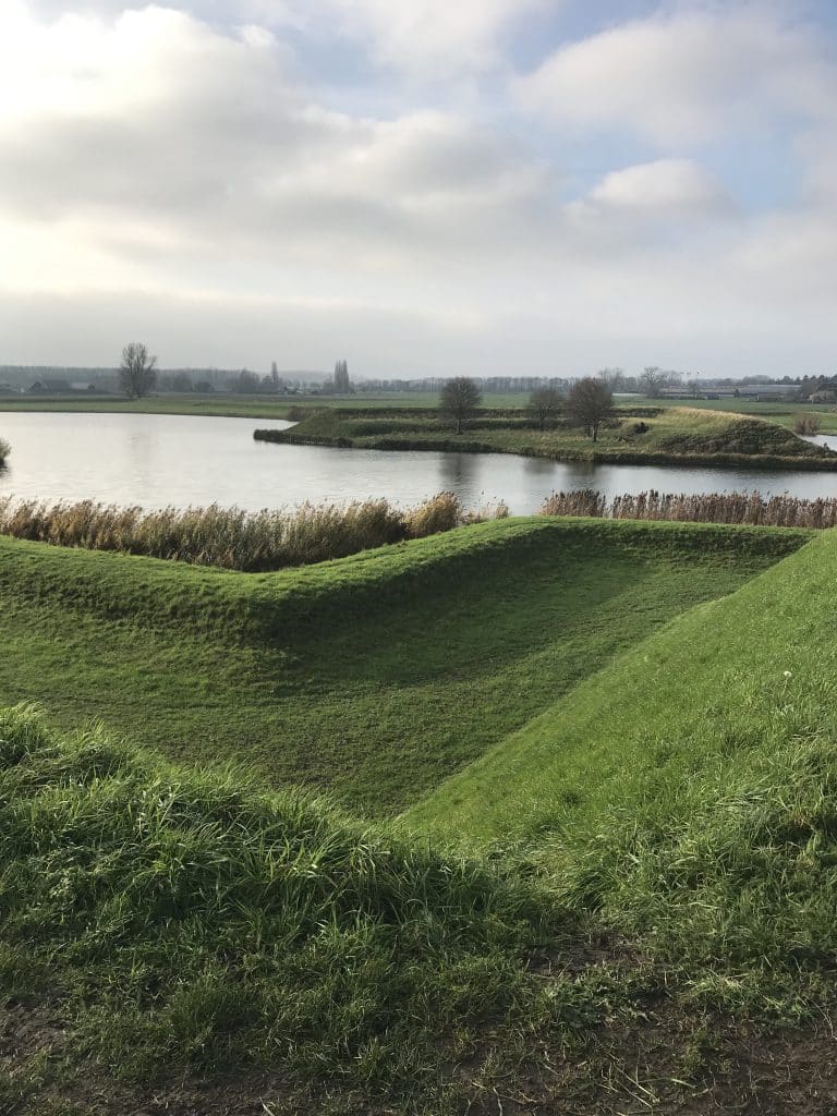
Summer dike, winter dike, channel, floodplain ... who remembers their geography lessons? Anyone who wants to see that dry theory come to life should not miss a visit to the Struikwaard. In this nature reserve along the Afgedamde Maas near Giessen you can admire the summer and winter dike, walk through the floodplains and enjoy a special piece of nature in Biesbosch Line.

Century-old floodplain

The floodplains between Giessen and Andel are described early on: in a court document from 1296 the area already appears. But for the Struikwaard as we know it today, we do not have to go so far back in history.

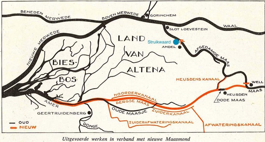
In 1904, the Merwede, Rhine and Waal rivers were separated from the Meuse after centuries of increasing flooding. The Meuse was given a new mouth by digging the Bergsche Maas. The original "Andelsche" or "New" Meuse received a dam and has since been known as the Afgedamde Maas.

Since then, the Struikwaard has been used as farmland for many years. In 1995, the Struikwaard underwent one more major change. The old winter dike was no longer sufficient. Therefore, a new one was constructed about 100 meters to the northeast. The new outer dike area was designated a nature conservation area.

Unknown author, CC BY-SA 4.0 , via Wikimedia Commons

Nature Protection

The outer dike area in the Struikwaard is a young conservation area managed by Brabants Landschap. You'll find riparian forests (forest that grew naturally along rivers), reed beds, grasslands and a swamp zone at the bottom of the summer dike. Don't be surprised if you hear mooing: a small herd of Brand red cattle graze the area.

Partridges

Since 2013, the Struikwaard has been working hard to give the partridge a better home. The partridge is seriously threatened in the Netherlands. Wooded banks, hedges, branch rills and flowering herbs have been supplanted by monotonous arable fields. As a result, the partridge is losing both its food supply and its breeding grounds. In the Struikwaard these landscape elements are being restored, and with success. The population is increasing rapidly, and there is a good chance that you will encounter one. Partridges have an inconspicuous brown camouflage color, so keep a sharp lookout!

Pear Trees

Although there are no partridges in them, the pear trees along the Kerkepad in Giessen deserve attention. The Pear Tree Lane probably once originated as a path to cut the road from dike to church. The lane has been restored to its former glory. Especially in spring, the path is worth a visit for a walk among the pear blossoms. The lane is a municipal monument, the only unbuilt object that has that status in the municipality of Altena.

Church and Pear Lane

Stroll through the Struikwaard

In the New Dutch Waterline you will find the Struikwaard: a beautiful piece of nature on the banks of the Afgedamde Maas. Do you like walking in nature and are you curious about the heritage of the New Dutch Waterline in the Altena region? Then walk our'Rondje Fort Giessen'.

Along the way, enjoy all the beauty the Biesbosch Line has to offer: peace, space, nature and heritage.

Swallows and Kingfishers

The bank swallow also finds a good home in the Struikwaard. On the bank of one of the ponds in the area, conservation society Altenatuur has built a concrete swallow wall. Steep banks along rivers and ponds have become rare in the Netherlands. As a result, the bank swallow has lost its nesting place. It builds its nest by digging a "hole" in steep banks. The concrete wall with holes gives the animal a hand. The wall holds an embankment of sand and clay in place. The holes are the front doors; the swallows are allowed to decorate their homes themselves. And the "apartment building" pleases them. Up to 80 breeding pairs have been counted during breeding seasons.
The wall proves attractive not only to swallows, but kingfishers also occasionally nest there.

Blooming biodiverse dike

In November 2020, the dike was awarded a prize at Struikwaard: the dike is "the paragon of biodiversity in the river landscape. Brabants Landschap manages the dike as part of the nature in the Struikwaard. That means flower-rich verges with great biodiversity: plants such as bee orchid and nodding thistle and insects such as the red-black double-toothed and the dark wasp bee. And in addition to all the benefits for nature, such a flowered dike is also pleasing to the eye.

Beavers

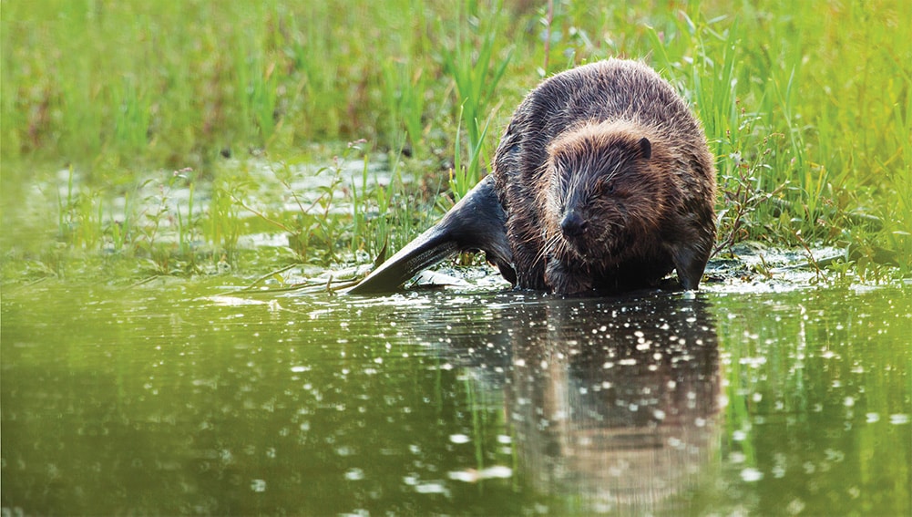
Beavers are doing well in Altena. In Struikwaard live some very stubborn specimens: for years they occupied a footbridge with their lodge. In the meantime, the family has sought other shelter, but beavers are still very active in the area. Watch carefully for gnawing tracks while hiking. And should you be lucky enough to spot a beaver: enjoy it but leave it alone, and stay at a considerable distance. You are a guest in its habitat.

Beaver tracks in the Struikwaard. copyright Bart Pörtzgen.

"Thus within the walls reigns the quiet tranquility of a dead past, disturbed only occasionally by the howling of schoolchildren, who have neither eyes nor feeling for what their city once meant. After all, who would dare to say out loud: "This is the thriving capital of the land of Altena. Hear the sound of horns and clarions, as a procession of nobles approaches the castle in splendor and splendor, where great men of the land negotiate!"

Bep M. Bresler, Tourist Champion ANWB, May 1940

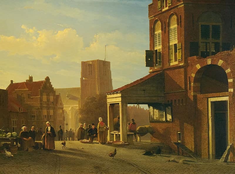
Jan Weissenbruch, The fish market of Woudrichem, ca. 1850 Photographer: 23 things for museums

Dull, dead, hardly worth visiting. You will be told, as a well-preserved fortified town. It was the verdict that Woudrichem had to make do with in the spring of 1940. That verdict is now much more positive, yet the image has not changed; in Woudrichem you find peace and time seems to stand still a little. But before that happened, a lot of water had to pass through the Merwede.

Strategic waterfront location

On the border of Holland and Gelre, "Where Maas and Waal wash together," that is where Woudrichem is located. A strategically important place, and the inhabitants knew it.

In the Middle Ages, Woudrichem was the capital of the Land of Altena. The city prospered: it had high city walls, a river toll, fishing rights and a large annual fair. It was a coming and going of high-ranking nobles and Woudrichem was often the city in which important negotiations between Holland and Gelre were held.

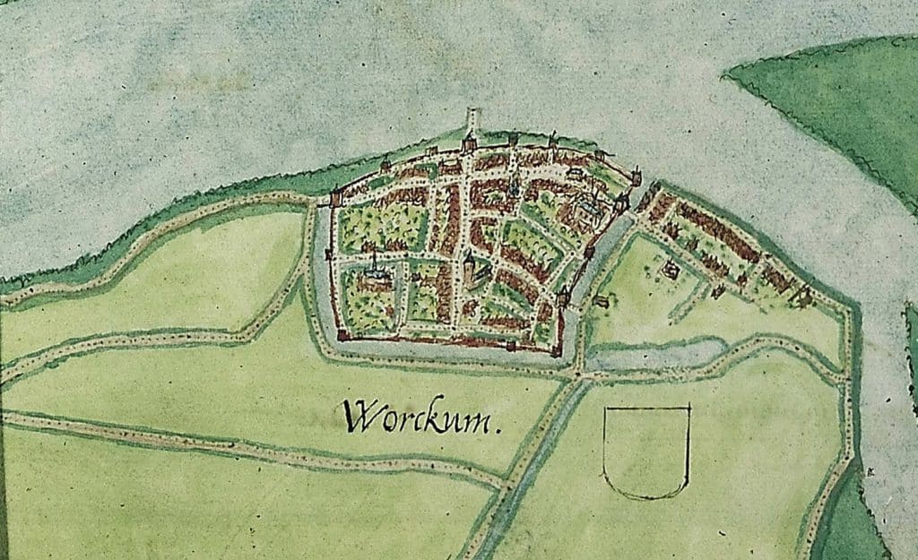
Map of Woudrichem in the late Middle Ages. Jacob van Deventer, 1545

That changed when Jan van Beieren moved the toll from Woudrichem to Gorinchem in 1420. The city lost an enormous source of income. A year later, the St. Elisabeth Flood brought economic life to a permanent halt. The city and the hinterland were devastated, which would cause poverty for decades. Things only improved again when the Kornsche dike between Dussen and Werkendam was built in 1461.

Construction of the fortified town

During the 80-year war, the city suffered greatly. Woudrichem was the battleground of battles between Beggars and Spaniards.

After the Sea Beggars captured Woudrichem from the Spanish in 1573, the outdated and dilapidated defenses proved unable to withstand new Spanish attacks. The city proved impossible to preserve. Therefore, the Beggars burned the city to the ground so that the Spaniards could no longer take advantage of it. Because William of Orange saw the city as a strategically important fulcrum, he ordered the city to be fortified. This "fortification" began in 1583 under the leadership of Adriaen Anthonisz of Alkmaar.

Unlike other cities, Woudrichem's new fortified town did not lie outside, but within the boundaries of the old city walls. The ravages of the 80-year war had left a large part of the city fallow. Moreover, during the Reformation, the Catholics had fled the city. Their monasteries had stood just inside the city walls, and their flight meant that this land no longer had to be expropriated: a suitable site for the new ramparts and moats. Woudrichem shrank to about three-quarters of its medieval size.

Fortifications of Heusden

Bike Tour: From fortified town to fortified town

You can never get enough of fortresses. Fancy a brisk bike ride? Then cycle the Fortress-to-Fortress route. In this tour from Woudrichem to Heusden you will visit the fortresses of Heusden and Altena. Along the way you will pass numerous interesting historical sites and buildings.

Step up and be surprised!

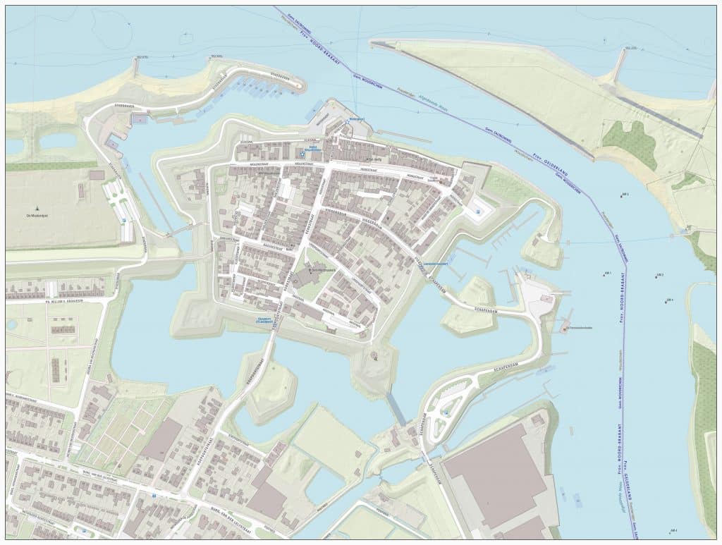
Map of the fortified town of Woudrichem

Garrison City

As a garrison town, Woudrichem prospered for a long time after the construction of the fortified town. The soldiers stationed in the town brought with them the necessary activity and income. They were accommodated (quartered) with the Woerkum families, who received allowances.

River fishing is also still a good source of income. Consequently, relative peace prevailed until the disaster year of 1672.

In that year, the French under Louis XIV invaded the south of our country. Although Woudrichem remained unscathed, it became painfully clear that the fortified town was inadequate. There is a lack of gunpowder, cannons and transport facilities. But even worse: the defenders realize that the fortifications are too weak. In strengthening them, another 16 buildings have to go. For the safety of the city and the protection of the province of Holland, three gates in the fortified town are moved. In the following years, the city also adds three ravelins, fortified islands in the moat, to the fortifications.

Woudrichem as part of the New Dutch Waterline

During the Patriot and French periods, nothing significant changes to the fortified town itself. However, the city itself suffered greatly at the end of the French era. Billeting of French and Prussian soldiers, shelling from Gorinchem and the harsh winter of 1814 - during which the Prussians demolished all the wood in the city and its surroundings - left the city half destroyed.

In 1815, Woudrichem officially became part of the New Dutch Waterline. This water line should protect the west of the Netherlands from invaders by means of inundation (the flooding of large pieces of land). East of the fortified town, the inundation sluice complex in the Maasdijk was therefore built. A little further on, at the Bakkerskil, such a lock will also be built: the Papsluis lock. They are special locks: impeller locks. They can open against high tide and are therefore always ready in case of imminent danger.

Kringenwet en Vestingwet: again poverty

When Woudrichem became part of the Waterlinie, the city had to deal with the circles law. This law prescribes that the field of fire (the area that weapons can reach) around a fortified town must remain free. Building within the first 1,000 meters from the edge of the fortified town is thus restricted or even prohibited. This makes it virtually impossible for the city to develop industrially and thus economically.

Woudrichem faces even more changes. The Fortification Act of 1874 orders all fortified towns to build barracks and sheds for the troops. Garrison soldiers no longer stay with families, but move to barracks. For the host families, allowances for board and lodging fell away. In addition, purchases for the soldiers' kitchens, for example, were arranged centrally. Thus a major source of income also disappeared for the town's middle class. Woudrichem was poor and would remain so until after World War II.

World Wars

World War I (1914-1918) brought Woudrichem little more than a temporary washing place (bathing facility) for the mobilized soldiers and some inconvenience from military exercises. The town, like the rest of the Netherlands, did not notice much of the actual violence of war. However, the town was put in a state of high alert. Woudrichem and the surrounding villages also received many Belgians who had fled the fighting in their country.

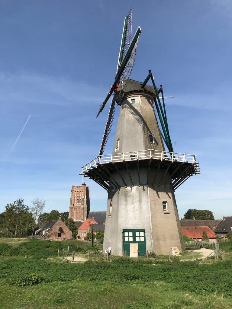
In the 1930s, poverty worsened in the city: fish stocks in the rivers fell to dramatically low levels. Many fishermen became unemployed, and poverty caused great hardship. Large families lived in too small houses, many of which were also in poor condition. No construction was allowed outside the fortified town: the Woerkumers had nowhere to go. This situation lasted until the 1950s. Even during World War II, the living conditions of the fortified town residents remained poor. Only their view changed: on April 21, 1945, the German occupiers blew up Korenmolen Nooitgedacht, which had supplied the town with flour since 1662.
Only when the town's military function was abolished in 1955 did the Woerkumers' situation change. Building was allowed again; the town could finally begin to grow.

Corn mill Nooitgedacht

A stroke of luck

Of all the fortified towns, Woudrichem was one of the last to be released from its military obligations. For the people of Woerkum much too late, but for us now a stroke of luck. Cities that were allowed to get rid of their fortresses as early as the 19th century often replaced them with more modern buildings and infrastructure. But in the early 20th century, resistance to these practices emerged. In Naarden, which received permission to "de-fortify" as early as 1926, protests arose for the first time against the demolition of the fortifications - and with it, the destruction of the city's character and cultural heritage.

Also in Woudrichem in the 1950s, plans were initially made in which the fortified town would be rigorously demolished. But partly due to the events in Naarden, these plans were changed and new buildings were constructed outside the fortified town.

The fortified town of Woudrichem was designated a protected townscape in 1972. Since then, it has also been thoroughly restored and stabilized. Today Woudrichem is flourishing again and we can enjoy the real "atmosphere of the past". Tranquility? Yes for sure. But boring, no way!

2020: Woudrichem from the air

Walking through fortified town Woudrichem

Curious about this beautiful town? Take a walk on the ramparts and through the fortified town of Woudrichem. With the city walk we set out for you, you will pass all the important places in town.

Do you really want to learn all about the fortified town and its inhabitants? Then take a walk with a guide from the city guides guild. On this page you will find more inspiration to explore Woudrichem further.

Thanks to Jos Korthout of the City Guides Guild for sharing his extensive knowledge about "his" Woerkum.

Want to read more about the fortified town of Woudrichem?

Vesting Woudrichem (Hollandse Waterlinie Erfgoed series) - Kees van Maastricht & Teus van Tilborg

Gaandeweg Woudrichem - Job Koekkoek

Urbanization of former city fortifications in The Netherlands between 1805 and 2013 - G. A. Verschuure-Stuip & B. Labuhn

Have you seen them yet?
Gnawed-off sticks?
Trees with gnaw marks?
Maybe even a gnawed tree?
The beaver is back in the Netherlands, and how. After it was released in the Biesbosch and Gelderse Poort in 1988, the population has grown considerably. And the beaver hotspot of the Netherlands? That is currently in the municipality of Altena, the Biesbosch Line that is. Between January 2018 and the end of September 2020, beavers were seen here no less than 533 times.

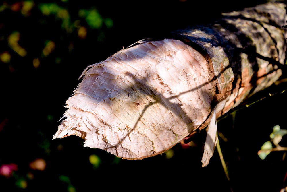
Tree gnawed down by beavers - photo Bart Pörtzgen

Hydraulic knitters

The beaver is a large rodent that prefers to live in and around water. It builds its own home: the beaver's lodge. The entrance to that lodge is underwater, safely protected from predators. Is there no water available where he wants it? A beaver does not resign itself to nothing. With its sharp, bright orange front teeth, it gnaws off branches and trees, which it uses to build dams. With these dams, he influences the water level around his lodge. He shifts the course of streams and rivers and even creates his own lakes. Dams of 150 meters long are no exception; beaver dams of 800 meters have even been found.
In the Netherlands, by the way, the beaver does not exhibit this behavior. Our country is water-rich enough for beavers to build a safe lodge without building their own Delta Works.

Beaver - photo National Park de Biesbosch

Family Animals

If beavers were humans, they would have had a row house, a 9-5 job and 1.7 children per family. They are true family animals. Beavers are monogamous and live in their lodge with their young. Per gestation, the beaver gives birth to 2-6 cubs. The young beavers do not leave their parental home until they are sexually mature after 2-3 years. Thus, sometimes as many as 10-20 animals live in one lodge. The beaver lodge consists of several rooms. A wet chamber, where the beaver can shake out its fur, and a dry one. This dry nest chamber is about 20 cm above water level.

Nature managers along rivers

Beavers have a considerable influence on nature in their territory. Not only do they shift the course of water, through their gnawing they also have a great influence on the biodiversity of the area. They like to eat bark, which they gnaw off trees. The trees often do not survive this in the long run. Dead trees attract insects, and those insects in turn attract birds, such as woodpeckers. Dead trees also pave the way for new vegetation. In this way, a beaver family can leave a solid mark on the landscape over time.

Not everyone is equally enthusiastic about this, by the way. The beaver builds where it wants, and that may well be in a place less convenient for people. For example, one decided to occupy a walkway with its lodge in Struikwaard for years. Beavers also sometimes dig tunnels in dikes, weakening them as a result. But in general, the arrival of a beaver is good news for nature.

Beaver hotspot Altena

In Altena, beavers live in the Biesbosch and along all the rivers. You can encounter their tracks in the floodplains Groesplaat and the Struikwaard. Find a beaver during a walk there? That's not easy, because they are shy nocturnal animals. Your best bet is to look for gnawed-off branches and gnaw marks on trees. You may be able to tell where it has been walking: its broad flat tail drags across the ground as it walks, leaving a distinct trail.

Trying your luck? Take a walk through the floodplain early in the morning or at dusk. Who knows, you might get lucky and see one of those scurrying nibblers in real life. Bring binoculars!

Gnawing tracks of the beaver - photo Bart Pörtzgen

What prehistoric snails have to do with modern wildlife management - and how to enjoy them at Kornsche Boezem.

Have you ever found your car under a layer of fine Sahara sand first thing in the morning? Probably you paid little attention to it at the time. Maybe you just thought: and I had just washed it. Here in the Netherlands, that dust is at most a little annoying. But did you know that this dust contains important minerals for nature? And did you know that the Amazon rainforest would not exist without these flown-in minerals?

Far from my bed you might think. But Altena has just as wonderful an invisible connection to another area "far away": The Kornsche Boezem would look very different without prehistoric snails from the Belgian Kempen.

If you want to know more about the origins of the Kornsche Boezem and its connection to the Kempen, we have to 12.000 years back in time. We are going in giant leaps, so hold on tight.

12.000 years of geology in 2 minutes

12.000 years ago, the Altena region was directly connected to the sea. The area was a marshy delta that flooded regularly. Three types of soil were formed in that Delta: peat, higher ridges of sand and in the lower bowls clay was deposited: bowl clay. It was a rugged, uninhabited landscape.

About 5,500 years ago, the first people settled on the island. They built their settlements on the higher sandy grounds. There they sat high and dry, protected from floods.

Middle Ages: pressing on the sand

But in the early Middle Ages, around the year 1100, the population grew. The sandy soil became too cramped, so the wet, lower-lying areas also had to be reclaimed. The Middle Ages constructed a system of ditches, waterways, storage basins and dikes. The delta changed into a real polder: the Groote or Hollandsche Waard.

Hiking in the Kornsche Boezem

The Kornsche Boezem is a small but fine nature reserve near Dussen. Here you can enjoy special nature: from old willows to marshy hay meadows with special plant species such as crab crab, kingcup and marsh fritillary.
The area is freely accessible to hikers.

Caution! The Kornsche Boezem is a wet natural area. Sturdy shoes or boots are not a luxury.

You can park just past Noordeveldse molen (Kornsche Boezemweg 4, Dussen).

Crabber in the Kornsche Boezem

Second St. Elizabeth flood: origins of the Kornsche Boezem

The second St. Elizabeth's Flood (1421) and the floods in 1423 made big holes in the dikes. That meant the end of the Groote Waard. The tides got hold of the land again. Especially in the west of the area, near the Hollands Diep, the land eroded by the incoming and outgoing water. A new delta formed. That delta is still there: the Biesbosch.

With new dikes and a new water regime, the area was then made habitable again. One of the new storage basins in this water system was De Kornsche Boezem.

We're almost there: 1954, the land consolidation law

After World War II, Altena was still a very wet area. Because of the many ditches and lots, the land was fragmented. A farmer's land was often scattered throughout the region. If you want to farm effectively, you need large contiguous pieces of land, where one optimal water level can be set for the crop growing there. The land consolidation act offered a solution: farmers exchanged their lots. Ditches and ditches were filled in and moved. This made room for efficient agriculture and cattle breeding.

The land consolidation act also stipulated that space for nature should remain. In Altena, the Kornsche Boezem was designated as a nature reserve. In the middle of the rapidly changing polder, time was stopped in this piece of nature.

There they are: prehistoric snails

Back to the snails. The Belgian Kempen and the Altena region, as mentioned, are invisibly connected. Only that connection is not in windblown dust, but in groundwater. The rainwater that seeps into the soil in the area of Lommel-Neerpelt (B) surfaces again in the land of Heusden and Altena as seepage: groundwater that seeps out. Before rainwater turns into seepage, it has traveled a journey of some 30,000 years. Not only does the water travel at snail's pace, it filters through layers of sandy river deposits containing lots of lime along the way. That lime? That comes from prehistoric snail shells and other shells. The seepage in the land of Heusden and Altena is therefore lime-rich and iron-rich. These minerals provide a special flora and fauna.

But what does that have to do with nature management?

In the Kornsche Boezem the water level is carefully managed with ditches, ditches, culverts and weirs to allow for seepage. It is precisely in this area that you will find unusual plants such as crab crab, holly pipe and water sedge. Also the protected moor frog and crayfish thrive here.

And good news for nature: in September 2020, the Forestry Commission will add a new parcel to the Kornsche Boezem. Until now, this parcel had an agricultural use, but now it will be reestablished as humid hay meadow. Through careful nature management at Kornsche Boezem, hopefully we can continue to enjoy the work of prehistoric snails in Altena into the distant future.

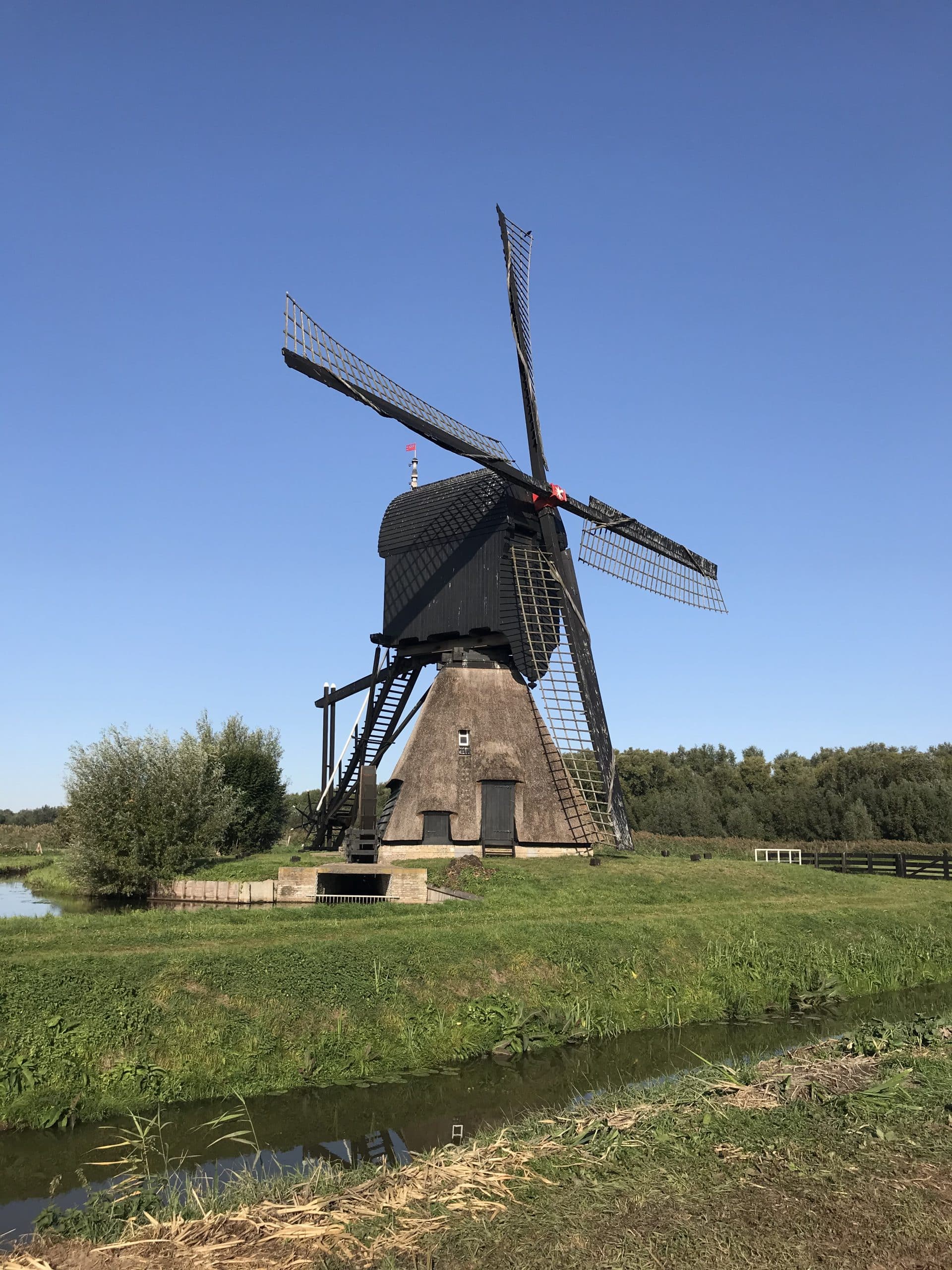
Noordeveldse Molen The Noordeveld Mill

The Noordeveldse Molen is the last remaining of 7 polder mills that have been used to drain the polder near Dussen since 1470. The Noordeveldse molen is the youngest of the bunch, it was built in 1795. The mill served until 1962, after which its task was taken over by steam and later diesel scoop wheel pumping stations.

The seesaw watermill burned down partially in 1992, probably due to arson. Fortunately, after a restoration, you can admire it again since 1997. When the mill is running, you are welcome!

You can find the Noordeveldse Molen on the Kornsche Boezemweg 4 in Dussen

linkedin facebook pinterest youtube rss twitter instagram facebook-blank rss-blank linkedin-blank pinterest youtube twitter instagram